Finish Projects up to 2 Months Early With Our Drone Data
Got questions? We're here to help you!
Click below to talk with a human.
We help construction teams reduce costs by up to 20%
Mapping, LiDAR, and thermal imaging solutions that provide accurate, timely site data for construction managers.
How Our Services Benefit Construction Projects:
Watch below to see how we can reduce site survey costs by up to 50%, optimize material management, help you finish projects 2 months early, and more.
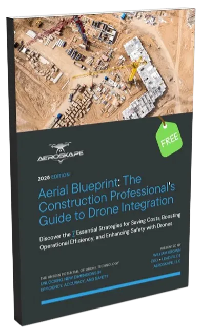
Download Our Drone Integration Guide & Request a Quote Today!

To start, download a copy of our Drone Integration Guide for construction and request a free quote - or give us a call.
How Our Services Benefit Construction Projects:
Watch below to see how we can reduce site survey costs by up to 50%, optimize material management, help you finish projects 2 months early, and more.
Download Our Drone Integration Guide & Request a Quote Today!
To start, download a copy of our Drone Integration Guide for construction and request a free quote - or give us a call.
“Thanks to Aeroskape, we reduced our project costs by 20% through more efficient planning and site management.”


“Aeroskape’s aerial solutions doubled our on-site efficiency by providing accurate, timely data that helped preempt potential issues.”


“The precision of Aeroskape’s imaging technology is unmatched, making it an indispensable part of our construction planning phase.”


"We enlisted Aeroskape to inspect a newly installed roof and solar panels. Once again, they delivered detailed, high-quality visuals that were invaluable in completing the project and coordinating with our contractors."

"Aeroskape's expertise in drone operations - especially in construction-focused aerial mapping and data collection - is top-notch."
"Aeroskape provided excellent service for my project. Pilot knows the rules and regs to fly safely, and the tech knowhow to get my data successfully! Highly recommend Will and Aeroskape!"
"We can recommend Aeroskape with confidence for their quality work and reliability."
"I had an opportunity to work with Aeroskape on some thermal imaging of a PVC roof system. William made sure to capture all the anomalies I was looking for and provided a quick turnaround on the photos."

“Thanks to Aeroskape, we reduced our project costs by 20% through more efficient planning and site management.”
“Aeroskape’s aerial solutions doubled our on-site efficiency by providing accurate, timely data that helped preempt potential issues.”
“The precision of Aeroskape’s imaging technology is unmatched, making it an indispensable part of our construction planning phase.”
"We enlisted Aeroskape to inspect a newly installed roof and solar panels. Once again, they delivered detailed, high-quality visuals that were invaluable in completing the project and coordinating with our contractors."
"Aeroskape's expertise in drone operations - especially in construction-focused aerial mapping and data collection - is top-notch."
"Aeroskape provided excellent service for my project. Pilot knows the rules and regs to fly safely, and the tech knowhow to get my data successfully! Highly recommend Will and Aeroskape!"
"We can recommend Aeroskape with confidence for their quality work and reliability."
"I had an opportunity to work with Aeroskape on some thermal imaging of a PVC roof system. William made sure to capture all the anomalies I was looking for and provided a quick turnaround on the photos."


Our Services.
We help construction teams gain accurate site intelligence without slowing down operations.

*Mapping & Surveying
High-accuracy orthomosaics, 3D models, and measurements that support planning, earthwork tracking, and project verification.

Progress Monitoring
Consistent aerial documentation that keeps stakeholders aligned, reduces site visits, and provides visual proof of progress.

Site Inspections
Safer, faster inspections for construction sites without scaffolding or shutdowns - including thermal imaging.

Volumetrics
Precise cut-and-fill calculations for earthwork, with ongoing tracking of stockpiles to verify quantities for billing and planning.
As-Built
Capture lasting records of each construction phase and document underground utilities before they’re covered.

3D Models
High-res 3D mesh & point cloud models designed for clear visualization, precise clash detection, and seamless stakeholder communication.
Progress Monitoring
Consistent aerial documentation that keeps stakeholders aligned, reduces site visits, and provides visual proof of progress.
*Site Mapping
High-accuracy orthomosaics, 3D models, and measurements that support planning, earthwork tracking, and project verification.

Inspections
Safer, faster inspections for construction sites without scaffolding or shutdowns - including thermal imaging.
Volumetrics
Precise cut-and-fill calculations for earthwork, with ongoing tracking of stockpiles to verify quantities for billing and planning.
As-Built
Capture lasting records of each construction phase and document underground utilities before they’re covered.
3D Models
High-res 3D mesh & point cloud models designed for clear visualization, precise clash detection, and seamless stakeholder communication.
Frequently Asked Questions.
Aeroskape's aerial imaging provides high-resolution, real-time visual documentation and informational data that enhances decision-making, supports progress monitoring, and helps teams stay aligned with project timelines in Northern California.

Our flexible scheduling allows for daily, weekly, or monthly aerial captures, depending on your project's needs and complexity, ensuring you always have up-to-date information.
Our dedication to using cutting-edge technology, customized solutions, and our deep understanding of the construction industry sets us apart, making us the preferred partner for local superintendents and construction companies.
We prioritize safety and confidentiality with strict protocols and state-of-the-art equipment to protect your site's integrity and privacy during all aerial imaging operations.
Yes, we offer thermal imaging solutions that can help identify potential electrical issues, insulation breakdowns, and other critical insights that are not visible in standard imaging.
Get In Touch
Address
Office: Morgan Hill, CA 95037 United States
Phone Number:
(669) 232-8483
*Disclaimer: Aeroskape, LLC does not provide Professional Land Surveying services. Aeroskape’s services do not include the determination of property boundaries, contours, monuments, or the authoritative position of land or fixed objects as defined under California Business & Professions Code §8726. All deliverables are provided for planning, visualization, documentation, and informational purposes only. When survey-grade or legal deliverables are required, clients should consult a licensed Professional Land Surveyor (PLS).
